Skip to content
← Brussels

Brussels / Gothic & folk humour

Central Brussels: Gothic buildings and three bronzes

A bronze girl behind iron bars, a bronze dog at a bollard and a bronze boy in a niche of blue stone are spread along this walk through central Brussels. Between them come a 96-metre Gothic tower, three arcades under a glass roof and a square created after the river Senne was covered.

5.1 km on foot · 14 stops

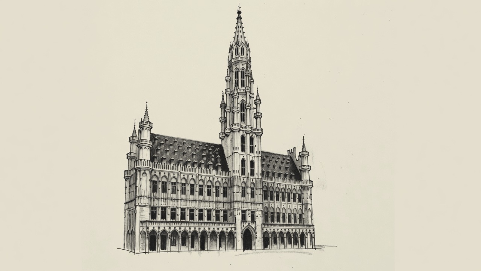
Charcoal illustration of Brussels Town Hall: a long Gothic front with arcades and a tall openwork tower.
Brussels Town Hall · The Gothic front on the Grand-Place and its tower. Charcoal illustration, not a survey drawing.

Building on the Grand-Place began in the 11th century, the century in which work also started on the church that is now St. Gudula; the Church of St. Nicholas was founded around 1125. The Town Hall dates from 1401 to 1455. In 1695 French troops bombarded Brussels and the greater part of the square was lost; the houses around it were rebuilt in the years after.

The Botanical Garden, where the route begins, was created in 1826. The Saint-Hubert Galleries were built in 1846 and 1847, the river Senne was covered between 1867 and 1871 and the Place de Brouckère was created afterwards, and the Bourse Palace went up between 1868 and 1873. The King's House on the Grand-Place was rebuilt in neo-Gothic style in the same century. Three bronzes are spread along the route: Manneken Pis, put in place in 1619; Jeanneke Pis, set up in 1987 as its counterpoint; and Het Zinneke, a dog that followed in 1999.

Before you set off

This route was drawn on the map and has not been walked by us yet. It has not been assessed for step-free access.

Your pace, your stops

We don’t give walking times: everyone moves through a city at a different pace. A route is a suggestion that links places worth seeing. You decide where to stop and what you can take on today.

1234567891011121314N ↑
Botanical Garden0.0 / 5.1 km

Track sketch · north up · not a street map · Route data © OpenStreetMap contributors

01A garden created in 1826 and relocated in 1938.50.8547° N · 4.3653° E

Botanical Garden

The Botanical Garden was created in 1826 on the Rue Royale, in Saint-Josse-ten-Noode, close to the Northern Quarter financial district. It stood there until 1938, the year of its relocation to Meise, in Flemish Brabant, where the National Botanic Garden of Belgium is.

The main orangery became Le Botanique in 1984: a music venue and cultural complex that belongs to Belgium's French Community.

Next on footThe Belgian Comic Strip Center lies to the south-west.

02An Art Nouveau building by Victor Horta, given over to Belgian comics.50.8512° N · 4.3601° E

Belgian Comic Strip Center

Victor Horta designed the building at 20, rue des Sables for the former Magasins Waucquez, in the Art Nouveau style. It now holds the Belgian Comic Strip Center, also called the Comic Art Museum, a museum devoted to Belgian comics.

Next on footSt. Gudula lies to the south.

03The cathedral, begun in the 11th century and Gothic by the 16th.50.8476° N · 4.3603° E

St. Gudula

St. Gudula, in full the Cathedral of St. Michael and St. Gudula, is named for the two saints who are patrons of the City of Brussels. A Romanesque church was begun in the 11th century where a chapel had stood, and by the 16th century the building had largely taken the Gothic form it has now, a major example of the Brabantine Gothic. Later centuries often altered the interior. It includes late Gothic and Baroque chapels; the neo-Gothic decoration, some of the stained glass in the aisles included, comes from 19th-century restoration. The church is also known for its music: it has two pipe organs and very large bells.

The church was raised to cathedral status in 1962, as co-cathedral of the Archdiocese of Mechelen–Brussels alongside St. Rumbold's Cathedral in Mechelen. It is Belgium's national church and the official seat of the country's Primate, and it often hosts royal weddings, state funerals and, on Belgian National Day, the Te Deum. The Parvis Sainte-Gudule, a large forecourt, has been its setting from the middle of the 20th century, after the North–South connection was built.

Next on footThe Saint-Hubert Galleries lie to the west.

04Three glazed arcades of 1846 and 1847.50.8478° N · 4.3550° E

Saint-Hubert Galleries

The Saint-Hubert Galleries are three glazed shopping arcades: the King's Gallery, the Queen's Gallery and the Princes' Gallery. The architect Jean-Pierre Cluysenaar designed and built them between 1846 and 1847, earlier than Saint Petersburg's Passage and Milan's Galleria Vittorio Emanuele II. Like those two, they have paired, regular façades whose distant model is Vasari's courtyard at the Uffizi in Florence, long and narrow like a street.

The shopfronts are arched and glazed, with pilasters between them and two storeys above, in an Italianate manner drawn from the Cinquecento. Overhead is an arched roof of glass panes on a fine cast-iron frame. The galleries are close to the Grand-Place, and the Rue des Bouchers is one of the streets that border their block on the west.

Next on footJeanneke Pis lies to the north-west.

05A bronze girl of 1987, made as a counterpoint to Manneken Pis.50.8486° N · 4.3541° E

Jeanneke Pis

Jeanneke Pis is on the east side of the Impasse de la Fidélité, a narrow dead end about 30 metres long that runs north off the Rue des Bouchers, a street full of restaurants. The name is Dutch for 'Little Pissing Joan'. The bronze statue is 50 centimetres and shows a small girl, naked, her hair in short pigtails, crouched to urinate; the base is blue-grey limestone.

Denis-Adrien Debouvrie commissioned the fountain in 1985, and it was set up in 1987, conceived as a counterpoint to Manneken Pis, the last stop of this walk. Iron bars guard it against vandalism.

Next on footLa Monnaie lies to the north.

06The opera house, third theatre on its site.50.8494° N · 4.3540° E

La Monnaie

La Monnaie is an opera house on the Place de la Monnaie, and the name covers two things: the building and the National Opera of Belgium, the federal institution housed in it. In Dutch it is De Munt, and both names mean the Mint. It is the country's leading opera house and among the handful of cultural bodies that the Federal Government of Belgium funds; regional governments pay for the Opéra Royal de Wallonie and the Vlaamse Opera.

The present building is the third theatre on this site. Its façade dates from 1818 and was substantially altered in 1856 and again in 1986. The foyer and auditorium are of 1856; almost everything else in the building was thoroughly renovated in the 1980s. The Rue Neuve and the Place de Brouckère are both close by.

Next on footThe Place de Brouckère lies to the north.

07A square created after the river Senne was covered.50.8515° N · 4.3528° E

Place de Brouckère

The Place de Brouckère was created after the river Senne was covered between 1867 and 1871. The Temple of the Augustinians stood here until its demolition in 1893. The square is about 50 metres by 350 and almost entirely paved.

Its name honours Charles de Brouckère, who was mayor of the City of Brussels, taught as a professor at the Free University of Brussels and had an important political part in the Belgian Revolution of 1830. To the north the Boulevard Émile Jacqmain and the Boulevard Adolphe Max form a Y; to the south is the Boulevard Anspach. Hotels, restaurants, theatres and a cinema surround the square.

Next on footThe Béguinage Church lies to the north-west.

08A Gothic church partly destroyed in 1584 and rebuilt in Baroque.50.8529° N · 4.3503° E

Béguinage Church

The Béguinage Church, dedicated to St. John the Baptist, is a Catholic parish church on the Place du Béguinage. The original church was Gothic, of the late 13th century, and belonged to the Great Beguinage of Brussels. Calvinists partly destroyed it in 1584, and it was rebuilt afterwards.

The rebuilt church is the one standing today. Lucas Faydherbe, a Flemish architect, is credited with it, and it is a notable example of the 17th-century Brabantine Baroque, with its Italian influence. The Place Sainte-Catherine and the Grand Hospice Pachéco are not far away.

Next on footHet Zinneke lies to the south-west.

09A bronze dog of 1999, made in the manner of the boy and the girl.50.8488° N · 4.3457° E

Het Zinneke

Het Zinneke means 'the mutt' in Brusselian dialect. Tom Frantzen made the bronze, which was set up in 1999 where the Rue des Chartreux meets the Rue du Vieux-Marché-aux-Grains. It shows a dog relieving itself against a bollard, in the vein of Manneken Pis and of Jeanneke Pis, and it is sometimes called Zinneke Pis for that reason.

The sculpture is an example of zwanze, the folk humour popular in Brussels. The Halles Saint-Géry, at once a market hall and a cultural centre, are not far off.

Next on footThe Church of St. Nicholas lies to the east.

10Among the four earliest churches of Brussels, beside the Bourse Palace.50.8478° N · 4.3517° E

Church of St. Nicholas

The Church of St. Nicholas was founded around 1125 and counts among the four earliest churches of Brussels. It is also the best preserved through its successive stages of building. Its western façade, the main one, dates from the 1950s. Its listing as a monument dates from 5 March 1936, the year in which St. Gudula and the Béguinage Church were also listed.

Next to it is the Bourse Palace, where the Brussels Stock Exchange used to sit, on the Boulevard Anspach. Léon-Pierre Suys designed it in an eclectic style that borrows from the neo-Renaissance and the Second Empire, and it went up between 1868 and 1873. The site had been the Butter Market, which in turn had been built over a Franciscan convent; remains of that convent have been dug up. The Place de la Bourse takes its name from the building.

Next on footThe Town Hall lies to the south.

11The only medieval building left on the Grand-Place.50.8465° N · 4.3516° E

Town Hall

The Town Hall stands along the southern side of the Grand-Place and was built between 1401 and 1455, one stage at a time. It is the only medieval building left on the square. The façade is richly ornamented and the tower is 96 metres high; the whole is regarded as a masterpiece of civil Gothic, and of the Brabantine Gothic already met at St. Gudula.

The three classicist wings at the rear date from the 18th century. In 2023 the mayor, aldermen and municipal administration moved to the Brucity building, which makes the Town Hall the former seat of the municipality.

Next on footThe Grand-Place lies to the east.

12The central square, destroyed in 1695 and rebuilt.50.8467° N · 4.3525° E

Grand-Place

The Grand-Place, Grote Markt in Dutch, is the square at the centre of Brussels: 68 metres by 110, paved throughout. The guildhalls around it are Baroque and belonged to the former Guilds of Brussels; two larger buildings stand with them, the Town Hall and the King's House, which is neo-Gothic. The square was begun in the 11th century and took until the 17th to be largely finished.

French troops bombarded Brussels in 1695, in the course of the Nine Years' War, and the greater part of the square was lost. The façade and tower of the Town Hall, which the artillery had used as its aiming point, withstood the incendiary balls, as did some stone walls. The houses around the square were rebuilt in the years that followed, which gave it the appearance it has today, and from the mid-19th century it was thoroughly renovated. UNESCO listed it as a World Heritage Site in 1998. Every second August, in even years, a very large flower carpet is laid in the centre, and a Christmas tree has gone up each year since the mid-20th century.

Next on footThe Brussels City Museum lies to the north-east.

13The city's own history, kept in the King's House.50.8469° N · 4.3529° E

Brussels City Museum

The Brussels City Museum is on the northern side of the Grand-Place, facing the Town Hall. The idea dates from 1860 and the opening from 1887. It covers the City of Brussels, its history and its folklore, from the founding of the town to modern times, through paintings, sculptures, tapestries, engravings, photographs and models, among them a scale model of the town in the Middle Ages. The original Manneken Pis is stored here.

The building is the King's House, Maison du Roi in French and Broodhuis, the Bread House, in Dutch. It was erected between 1504 and 1536 and rebuilt in the 19th century by the architect Victor Jamaer in the neo-Gothic style it has now.

Next on footManneken Pis lies to the south-west.

14The bronze boy put in place in 1619, the model for Jeanneke Pis and Het Zinneke.50.8450° N · 4.3499° E

Manneken Pis

Manneken Pis is a bronze fountain figure of 55.5 centimetres, where the Rue du Chêne meets the Rue de l'Étuve, a pedestrian street. The name is Dutch for 'Little Pissing Man', and the figure is a naked boy who urinates into the basin. Its existence is documented from the mid-15th century; Jérôme Duquesnoy the Elder, a Brabantine sculptor, redesigned it and it was put in place in 1619. The niche is of blue stone, in rocaille style, and is of 1770.

Thefts and damage recur through the statue's history, and the figure on display here since 1965 is a replica. It is regularly dressed, from a wardrobe of around one thousand costumes, shown since 2017 at the GardeRobe MannekenPis museum. Like Het Zinneke, it is counted as an example of zwanze, and of belgitude for the way it mocks itself.

End of the routeThe route ends here.

Open in Google Maps Download GPX

This track was calculated on a map and has not yet been checked on foot. Follow public paths and local signs if conditions differ.

Beyond the walk

By public transport from this route

Three places are reached by tram from the stop Gillon. St. Mary's Royal Church is one stop away, at Sainte-Marie - Sint-Maria. The Church of Our Lady of Laeken is six stops away, at Princesse Clémentine - Prinses Clementina, and Laeken Cemetery is seven stops away, at Moorslede.

Train World is reached by tram from the stop Sainte-Marie - Sint-Maria: get off at Schaerbeek Gare - Schaarbeek Station, seven stops on.

Routes and stops change, so check STIB/MIVB before travelling.