Skip to content
← Brussels

Brussels / Exhibitions & museums

Cinquantenaire Park: halls of the 1880 jubilee

A triple arch carrying a quadriga in bronze, exhibition halls laid out in a U, and, at the park's north-western corner, a mosque put up in 1897 as an exhibition sight. The halls hold cars, military history and antiquities.

1.5 km on foot · 7 stops

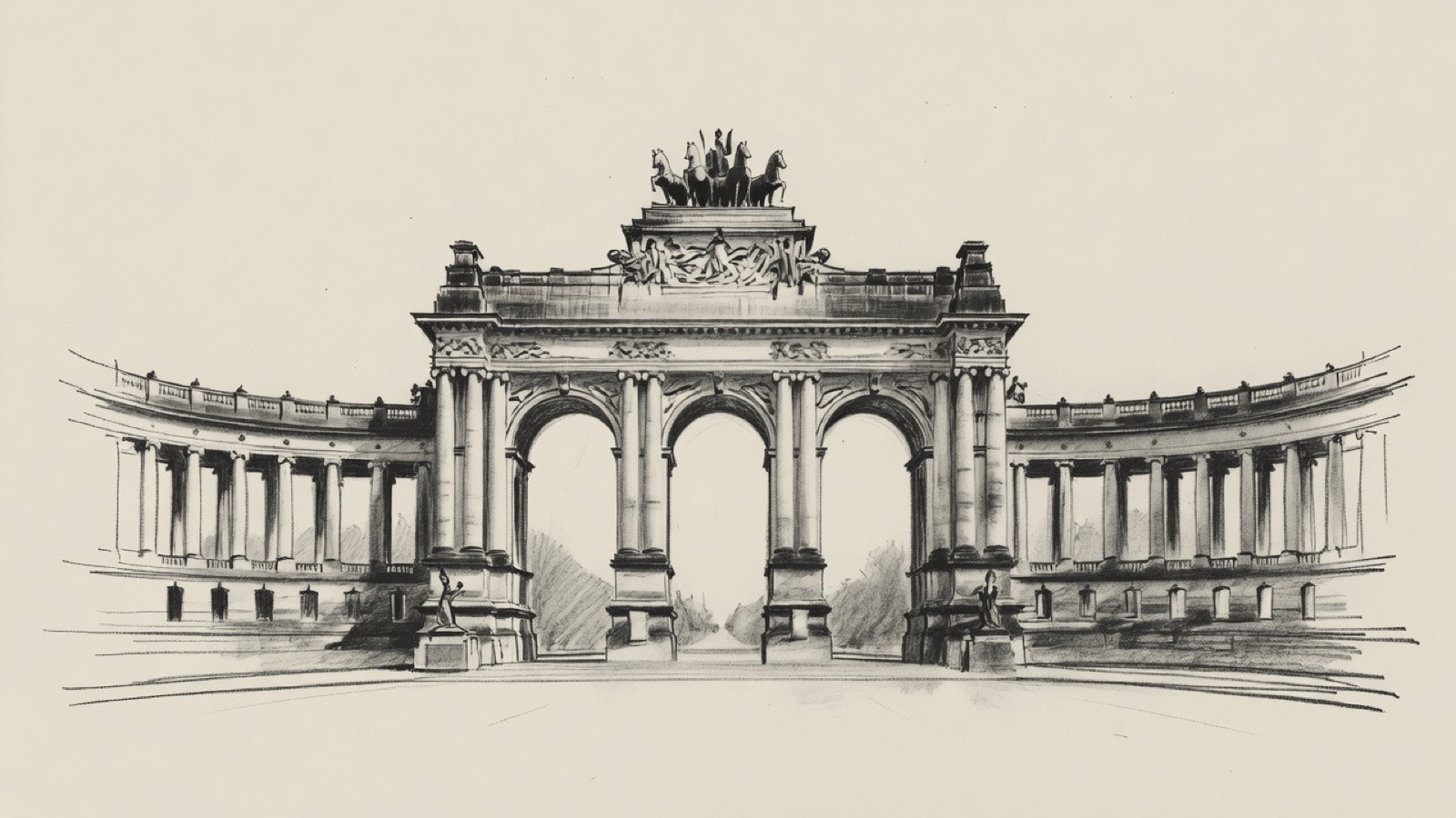
Charcoal illustration of the Cinquantenaire Arcade in Brussels: a triple arch with a quadriga on top and curved colonnades on both sides.
Cinquantenaire Arcade · The triple arch and its quadriga. Charcoal illustration, not a survey drawing.

The halls of Cinquantenaire Park go back to the National Exhibition of 1880, which marked fifty years since the Belgian Revolution. The Belgian government, with King Leopold II as patron, commissioned most of the U-shaped complex for that event. Later exhibitions added more structures, and trade fairs and festivals were held on the grounds in the early twentieth century. In 1930 the government set the site aside as a park for leisure.

The Royal Military Museum has had the northern half since 1880, the Art & History Museum has been in the southern half since 1889, and Autoworld joined it there in 1986. The arch of 1905 stands in the centre. The route ends in the north-western corner, at a building of 1897 that has been the Great Mosque of Brussels since 1978.

Before you set off

This route was drawn on the map and has not been walked by us yet. It has not been assessed for step-free access.

Your pace, your stops

We don’t give walking times: everyone moves through a city at a different pace. A route is a suggestion that links places worth seeing. You decide where to stop and what you can take on today.

1234567N ↑
Autoworld0.0 / 1.5 km

Track sketch · north up · not a street map · Route data © OpenStreetMap contributors

01The South Hall and its collection of vehicles50.8391° N · 4.3940° E

Autoworld

Autoworld fills the South Hall of the exhibition complex in Cinquantenaire Park, and has done since 1986. More than 300 vehicles are on show, cars and motorcycles alike, following the motor industry from its nineteenth-century beginnings to the present.

The collection is known for its early machines and for cars built in Belgium. Minervas are among them, and so are several limousines that belonged to the Belgian royal family. The Art & History Museum and the Royal Military Museum are its neighbours in the same complex.

Next on footThe Royal Military Museum lies to the north.

02The northern halls, held by one museum since 188050.8406° N · 4.3932° E

Royal Military Museum

The Royal Museum of the Armed Forces and Military History, also called the Royal Military Museum, occupies the pair of halls at the northern end of the complex. It has had the northern half to itself since 1880, the year of the National Exhibition for which most of these buildings were commissioned.

Next on footThe Cinquantenaire Arcade lies to the west.

03The memorial at the centre, aligned with the city50.8405° N · 4.3930° E

Cinquantenaire Arcade

The Cinquantenaire Arcade is a memorial at the centre of the park, and its middle section is a triple arch, the Cinquantenaire Arch. The arch dates from 1905, when it took the place of a temporary arcade by Gédéon Bordiau. On top stands a quadriga in bronze driven by a woman: she personifies the Province of Brabant and holds up the national flag.

The monument is oriented towards the centre of Brussels. On one side it is in line with the Rue de la Loi, which runs through the Leopold Quarter to the Royal Quarter, where the Belgian Parliament, the government and the Royal Palace sit. On the other side it is in line with the Avenue de Tervueren, which leads to Tervuren and the Royal Museum for Central Africa, once the Palace of the Colonies.

Next on footCinquantenaire Park lies to the west.

04The exhibition ground kept as a public park50.8406° N · 4.3928° E

Cinquantenaire Park

Cinquantenaire Park covers 30 hectares at the eastern end of the European Quarter. Its French name means park of the fiftieth anniversary: the Belgian government, with King Leopold II as patron, commissioned most of the U-shaped complex for the National Exhibition of 1880, held fifty years after the Belgian Revolution. Later exhibitions added more structures, and in the early twentieth century the grounds held trade fairs and festivals. In 1930 the government set the Cinquantenaire aside as a park for leisure.

The park's north-western corner has three more structures: the Great Mosque of Brussels, Victor Horta's Temple of Human Passions of 1896 and, dating from 1921, the Monument to the Belgian Pioneers in Congo. Metro lines and the Belliard Tunnel run beneath the park.

Next on footThe Royal Museums of Art and History lie to the south-west.

05The group of five that the Art & History Museum belongs to50.8394° N · 4.3916° E

Royal Museums of Art and History

The Royal Museums of Art and History are a group of five museums under the Belgian Federal Science Policy Office. One of the five, the Art & History Museum, is in the southern half of the complex and is the next stop. The others are the Musical Instruments Museum, the Halle Gate, the Horta-Lambeaux Pavilion and the Museums of the Far East.

Next on footThe Art & History Museum lies to the north.

06Antiquities and decorative arts in the southern half50.8394° N · 4.3916° E

Art & History Museum

The Art & History Museum has been in the southern half of the complex since 1889, and Autoworld has been there with it since 1986. It is a public museum of antiquities, ethnographic and decorative arts, and counts among Europe's largest art museums. Until 2018 it went by the name Cinquantenaire Museum.

Next on footThe Great Mosque of Brussels lies to the north-west.

07An exhibition building of 1897, a mosque since 197850.8432° N · 4.3878° E

Great Mosque of Brussels

The Great Mosque of Brussels stands in the north-western corner of Cinquantenaire Park. The building went up in 1897 as one of the sights of an exhibition. In 1978 Saudi Arabia made it a place of Muslim worship, and Saudi management lasted forty years. The Muslim Executive of Belgium ran it between April 2019 and June 2023.

Its standing as the leading religious institution among Belgian Muslims, and the part it was meant to play as a link between the Saudi and Belgian monarchies, have been argued over ever since it became a mosque. Thousands of Muslim students have been taught here.

End of the routeThe route ends here.

Open in Google Maps Download GPX

This track was calculated on a map and has not yet been checked on foot. Follow public paths and local signs if conditions differ.

Beyond the walk

By public transport from this route

Place Eugène Flagey can be reached by tram: board at Place Saint-Pierre - St-Pietersplein and get off at Flagey, six stops apart. Check STIB/MIVB before travelling.

Facts taken from the Wikipedia articles below (Wikipedia contributors, CC BY-SA 4.0) and rewritten for this route; this is not a copy of their text. Generated with editorial rules and checked 10 October 2026. Transport lines come from OpenStreetMap: confirm with the operator before travelling.