Skip to content
← Antwerp

Antwerp / Old ground, new uses

The Zuid, where courts and museums took over older ground

The walk starts at a courthouse opened in 2006 where trains used to arrive and ends at a synagogue built in 1893. Between them stand a gate carved in 1624 for a Spanish king and a museum with bronze chariots and seven portrait medallions on its walls.

2.2 km on foot · 7 stops

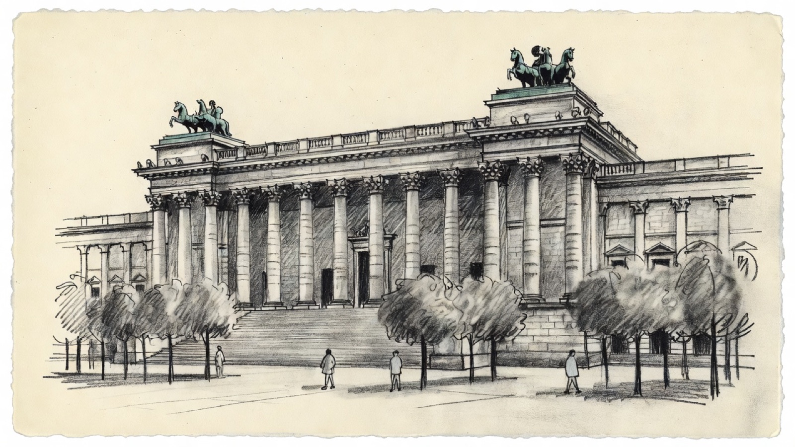
Charcoal illustration of the columned front of the Royal Museum of Fine Arts in Antwerp, with bronze chariots on the roof.
Royal Museum of Fine Arts · Columns and two bronze chariots. Charcoal illustration, not a survey drawing.

Two of the largest buildings in the Zuid occupy ground that once served another purpose. The Palace of Justice replaced Antwerp-South railway station, and the Royal Museum of Fine Arts sits in gardens laid out where the Antwerp Citadel had been. The district the walker sees today is the second use of the land, and in both cases the source of the change is still named: a station and a fortress gave way to a court and a museum.

The route runs from the courthouse east to Bolivarplaats, then north to the Waterpoort, a gate of 1624 that predates the courthouse by nearly four centuries. Three museums follow, for photography, contemporary art and the fine arts, and the last of them explains its own purpose in sculpture on the outside. The walk closes at the Hollandse Synagoge, raised three years after that museum opened by a community whose families had come from the Netherlands.

Before you set off

This route was drawn on the map and has not been walked by us yet. It has not been assessed for step-free access.

Your pace, your stops

We don’t give walking times: everyone moves through a city at a different pace. A route is a suggestion that links places worth seeing. You decide where to stop and what you can take on today.

1234567N ↑
Palace of Justice0.0 / 2.2 km

Track sketch · north up · not a street map · Route data © OpenStreetMap contributors

01A courthouse of 2006 on the ground of a vanished railway station.51.2041° N · 4.3879° E

Palace of Justice

Antwerp-South railway station used to occupy this ground, and it was pulled down in 1965. The Bolivar Tunnel now runs beneath, and above it stands the Palace of Justice, which Antwerp also calls the Law Courts, De Frietzakken and the Butterfly Palace. Three firms share the design: the Richard Rogers Partnership, VK Studio and Arup.

Eight courts of the district sit here, some hearing civil cases and others criminal ones. King Albert II opened the building on 28 March 2006.

Next on footBolivarplaats lies to the east.

02A square named after Simón Bolívar, where the Leien come to an end.51.2042° N · 4.3883° E

Bolivarplaats

The square is named after Simón Bolívar, the South American freedom fighter. The courthouse is its centrepiece, and building and square together close the Leien, one of the main axes of the city.

Several kinds of traffic meet here. An arm of the R10 ring road, the Singel, runs over the square, and underneath it the Bolivar Tunnel carries the A112 motorway from the Leien to the Antwerp Ring and on to the A12 for Brussels. Two tram lines come together as well: their platforms sit under the steps to the courthouse's main entrance, and the square has a loop where trams turn round. Cafés and restaurants stand along the edge, and the Karel de Grote-Hogeschool has two large campuses close by.

Next on footThe Waterpoort lies to the north.

03A gate of 1624, nearly four centuries older than the courthouse.51.2080° N · 4.3890° E

Waterpoort

The Waterpoort went up in 1624 and is the work of two sculptors: Johannes van Mildert carved it together with Huibrecht van den Eynde. It had two jobs at the start. One was practical, as a water gate on the Scheldt. The other was ceremonial: it honoured King Philip IV of Spain, which is why it also goes by the names Porta Regia and Coninckxpoort.

The gate now stands in the Zuiderdokken, in the Zuid. Coming straight after a courthouse of 2006, it is the far older of the two.

Next on footFOMU, the photography museum, lies to the north-west.

04The first of three museums, and the one given to photography.51.2089° N · 4.3873° E

FOMU Photo Museum

FOMU is the short name of Fotomuseum Antwerp, the city's museum of photography. It opens a run of three museums that takes up the middle of the walk, each devoted to a different kind of image.

Next on footM HKA, the museum of contemporary art, lies to the north-east.

05Antwerp's museum for the art of the present.51.2111° N · 4.3897° E

M HKA

M HKA stands for Museum van Hedendaagse Kunst Antwerpen, the city's museum of contemporary art. The abbreviation used to be written MuHKA.

With photography behind and the fine arts ahead, this stop is the most recent in what it shows.

Next on footThe Royal Museum of Fine Arts lies to the south-east.

06A museum in gardens where the Antwerp Citadel once stood.51.2089° N · 4.3944° E

Royal Museum of Fine Arts (KMSKA)

The Royal Museum of Fine Arts, KMSKA for short, dates from 1810, long before it had this home. Jean-Jacques Winders and Frans Van Dijk designed the neoclassical building. Work started in 1884, the doors opened in 1890 and the last of it was finished in 1894. The gardens around it cover ground that belonged to the Antwerp Citadel. Leopold de Waalplaats marks their edge together with three streets: Beeldhouwersstraat, Plaatsnijdersstraat and Schildersstraat. Like the courthouse at the start, the museum took the place of something else.

Inside are drawings, sculpture and painting made between the 1300s and the 1900s, a record of what was produced and what was collected in Antwerp, in Belgium and in the Northern and Southern Netherlands from the fifteenth century on. The outside says as much in stone and bronze. Thomas Vincotte made the two figures of Pheme, each in bronze and each driving a chariot pulled by horses. Seven round medallions carry portraits of artists, among them Jan van Eyck, Quentin Matsys, Frans Floris, Peter Paul Rubens, Erasmus Quellinus II, Boetius à Bolswert and Appelmans. Four large statues stand between them for Architecture, Painting, Sculpture and Graphics.

Next on footThe Hollandse Synagoge lies to the south-east.

07A synagogue of 1893, built by families who had come from the Netherlands.51.2076° N · 4.3967° E

Hollandse Synagoge

The Hollandse Synagoge stands at Bouwmeestersstraat 7, which gives it a second name, the Bouwmeester Synagoge. Its official title is Synagogue Shomré Hadas, and the congregation is Orthodox. Jewish life in Antwerp reaches back to the fourteenth century, yet the congregation was formally founded only in 1816.

Jews arrived from the Netherlands in the first years of the nineteenth century, and it was their descendants who put up this building in 1893. No synagogue of this size had existed in the city before. The date places it in the same years as the museum just seen, which was still being completed.

Next to it, where Schildersstraat meets Plaatsnijdersstraat, is De Vijf Werelddeelen, an art nouveau building that people in the city call Het bootje. Few buildings of that style in Antwerp are as widely known. Its two streets are also among those that edge the museum gardens.

End of the routeThe route ends here.

Open in Google Maps Download GPX

This track was calculated on a map and has not yet been checked on foot. Follow public paths and local signs if conditions differ.

Facts taken from the Wikipedia articles below (Wikipedia contributors, CC BY-SA 4.0) and rewritten for this route; this is not a copy of their text. Generated with editorial rules and checked 10 October 2026. Transport lines come from OpenStreetMap: confirm with the operator before travelling.

Another side of Antwerp

More routes in Antwerp

01Faith, trade, craft

Antwerp old town: churches and trades from St. James' to the Scheldt

Rubens is buried at the second stop and stands in bronze near the end, and between the two his paintings hang in three more churches. Around them the walk passes a butchers' guildhall, a fortress gate from the early 1200s, a printing house that ran for four centuries and a tower block from 1932 that was long outdone in height only by the cathedral.

5.2 km on foot · 21 stops

02Care, collecting, stage

Stadspark to the Rubenshuis: care, collections and a city stage

The walk starts in a park laid out on a former fortification and ends at the house a painter redesigned for himself. Between them come the spot where a southern gate once stood, a garden planted for medical students, a home for orphaned girls, and a theatre whose architect also drew the garden's gate.

2.9 km on foot · 9 stops

03Record & trade

Eilandje: a warehouse archive, a war memorial and two museums

A warehouse of 1858 on the Willemdok that now holds the city archive, with the MAS facing it. The route then goes west to the Loodswezen site on the Scheldt quays, where a memorial with about 25,000 names is planned, and north to the Red Star Line Museum. Next to the MAS it passes the site of the Oostershuis, a trading house that burned down in 1893.

1.7 km on foot · 4 stops

04Rail & arrival

Station quarter: the opera, Centraal and the Zoo

A short walk through the streets around Antwerp's main station. It starts at the opera house, passes the square where the city's buses gather and ends at two neighbours: a station building finished in 1905 and, next to it, a zoo founded in 1843.

1.2 km on foot · 5 stops