Skip to content
← Antwerp

Antwerp / Care, collecting, stage

Stadspark to the Rubenshuis: care, collections and a city stage

The walk starts in a park laid out on a former fortification and ends at the house a painter redesigned for himself. Between them come the spot where a southern gate once stood, a garden planted for medical students, a home for orphaned girls, and a theatre whose architect also drew the garden's gate.

2.9 km on foot · 9 stops

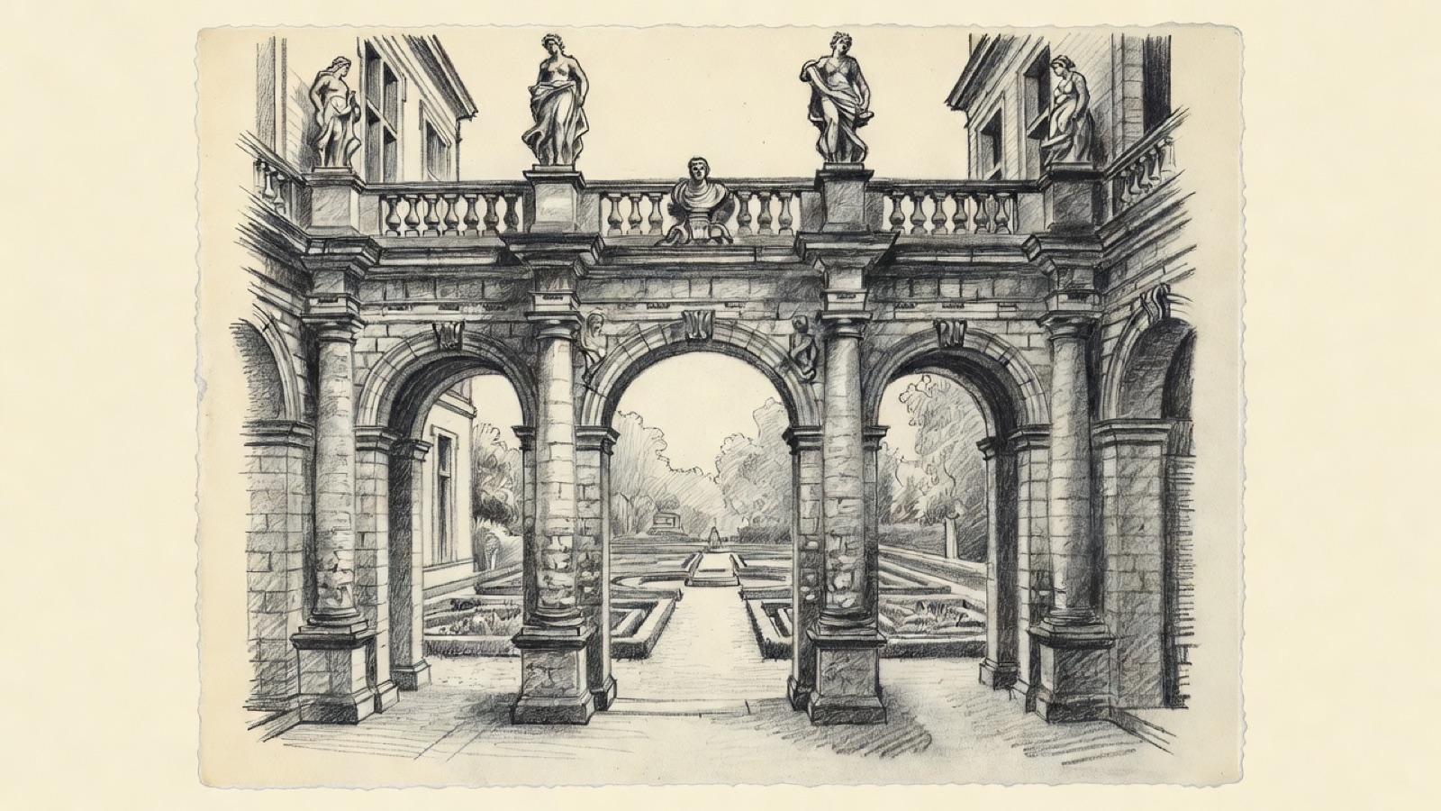
Charcoal illustration of the arched portico between courtyard and garden at the Rubenshuis in Antwerp.
Rubenshuis · The portico between courtyard and garden. Charcoal illustration, not a survey drawing.

South of the centre, Antwerp kept the things a city needs once trade has paid for them: a gate on the road to Mechelen and Brussels, a hospital with its own beds of herbs, a house where girls without parents were brought up. The first half of this walk passes through that ground, starting in a park that replaced part of the fortress. A gate once stood on that road, and the hospital garden became a botanical one in 1825, when a doctor laid it out again to serve a school of medicine.

The second half is about what people in Antwerp collected and staged. The orphanage holds paintings by Rubens and Jordaens next to the bowls its children ate from. A little further north is the museum built on what Fritz Mayer van den Bergh gathered, and after that the theatre Pierre Bourla designed for the city, the same man who drew the gate of the botanical garden. The route ends at the Wapper, where Rubens bought a house in 1610 and rebuilt it to his own drawings.

Before you set off

This route was drawn on the map and has not been walked by us yet. It has not been assessed for step-free access.

Your pace, your stops

We don’t give walking times: everyone moves through a city at a different pace. A route is a suggestion that links places worth seeing. You decide where to stop and what you can take on today.

123456789N ↑
Stadspark0.0 / 2.9 km

Track sketch · north up · not a street map · Route data © OpenStreetMap contributors

01A park on the ground of a former fortification51.2121° N · 4.4150° E

Stadspark

The Stadspark covers 14 hectares in the middle of Antwerp, on ground once occupied by the Herentals lunette, a part of the fortress of Antwerp. Its plan is a triangle that points north, with Van Eycklei along the wide southern edge, Rubenslei on the west and Quinten Matsijslei on the east.

The pond has a bridge that the architect Édouard Keilig built between 1867 and 1869. Water used to reach the pond from the Schijn by way of the Herentalse Vaart, and a pipe carried some of it on northwards to the breweries on Brouwersvliet, which drew from it until 1931. That supply has been shut off, so the pond now holds groundwater. Its level sank when water was pumped out of the new tunnels during the works on the Leien, leaving the pond nearly dry, and pumps have since been fitted to keep it up.

Next on footThe Kapel van het Allerheiligste Sacrament lies to the south-west.

02A convent chapel of the 1890s in red brick51.2090° N · 4.4098° E

Kapel van het Allerheiligste Sacrament

Ernest Stordiau was the architect of this neo-Gothic chapel on Hemelstraat, which went up between 1890 and 1892. Chapel and convent are both of red brick. The complex was built as a convent for women and now serves the Priestly Fraternity of St Pius X as its priory for Flanders.

The church has the plan of a cross with a single nave: four bays in the nave and one in the transept. On its front stands a figure of the Virgin Mary holding the Child.

Next on footHead north-west to where the Keizerspoort stood.

03Where the road south left the walled city51.2126° N · 4.4071° E

Keizerspoort

The record for this spot describes the St. Joris Gate, which took its name from Saint George and belonged to the Fortifications of Antwerp. Its place was close to where Kasteelpleinstraat now meets Leopoldstraat.

This was the way out of the city on the south side, for anyone bound for Mechelen or Brussels.

Next on footThe Plantentuin, the botanical garden, is to the north.

04A garden planted to teach medicine51.2142° N · 4.4062° E

Plantentuin (Den Botaniek)

Locals call it Den Botaniek, and sometimes Den Botanieken Hof or Kruidtuin. The ground on Leopoldstraat measures a little under one hectare and has grown plants for a purpose since the late 1700s: first for the Ecole Centrale, then as the bed of herbs, and afterwards of vegetables, belonging to the Sint-Elisabethgasthuis. In 1825 it became a botanical garden with a landscaped plan. The doctor Claude-Louis Sommé gave it that shape so that students at the école de médecine could follow their course in external pathology with the plants in front of them.

Pierre Bruno Bourla drew the gate at the entrance in 1826; the house for the gardener was added in 1870. Bourla was also the architect of the Orangerie, which today falls outside the garden's boundary. Linnaeus and de Jussieu are there as busts, and its front is lettered with the names Dodoens, Dumortier, De L'Escluse, Van Sterbeeck and De L'Obel. The city council has run the garden since 1926, and the herb garden gained protection as a landscape in January 1950. Some 2,000 plants grow here, with cacti and other exotics kept in the Conservatory.

Next on footThe Maagdenhuismuseum is to the west.

05The orphanage that grew up beside the hospital garden51.2144° N · 4.4050° E

Maagdenhuis Museum

The Maagdenhuis, the Maidens' House, stands on Lange Gasthuisstraat in a building of the 1600s. From about the middle of the sixteenth century until the close of the nineteenth it took in orphaned girls, known as maegdeckens. The garden you have just left supplied a hospital with herbs; this house brought up girls without parents.

It is counted among the smallest of Antwerp's museums. Part of what it shows is domestic: the everyday implements of the orphans and foundlings, old furniture, and papers recording the institution and how life went on inside it from the sixteenth century to the nineteenth. The other part is paintings and sculpture. Peter Paul Rubens and Jacob Jordaens are both represented, and so are Walter Pompe, Pieter Aertsen and Maarten Pepijn.

Next on footMuseum Mayer van den Bergh is to the north.

06One man's collection turned into a museum51.2155° N · 4.4050° E

Museum Mayer van den Bergh

Fritz Mayer van den Bergh (1858–1901) dealt in art and collected it on a large scale. The museum that bears his name rests on what he brought together. Most of the pieces come from Belgium and belong to the Renaissance and the Gothic age before it. Pieter Brueghel the Elder is among the painters represented.

At the Maagdenhuis the art arrived in the service of an institution. Here it was the choice of a single buyer.

Next on footThe Bourlaschouwburg is to the east.

07The city commissions a stage from its own architect51.2158° N · 4.4074° E

Bourla Theatre

Pierre Bourla, architect to the city and the designer of the botanical garden's gate, received the commission for this theatre from Antwerp in 1827. He gave it a neoclassical form and placed it where the Tapissierspand, the market for tapestries, had been. Building started in 1829 and the Belgian Revolution held it up, so the house was only completed in 1834. A French company owned it, which is why it opened as the Grand Théâtre, or Théâtre Royal Français.

Around 900 people can sit inside. Its resident company today is Het Toneelhuis, formed when the Koninklijke Nederlandse Schouwburg joined with the Blauwe Maandag Compagnie. Among Europe's municipal theatres, no other still keeps, as the Bourla does, the stage machinery it was built with, spread over five levels over and under the stage. Protection as a building came in 1938.

Next on footThe Wapper, a square, is to the north-east.

08A square named after a water crane51.2173° N · 4.4089° E

Wapper

The Wapper is a square between the Meir and the Stadsschouwburg, laid out in 1972. Its name comes from a large water crane that stood beside the Herentalse Vaart, the canal that also supplied the pond in the Stadspark; the crane served to draw, or wappen, drinking water from it. The square is known chiefly for the Rubenshuis, and another painter, Alexander Adriaenssen, lived here too.

On the corner with the Meir stands the Paleis op de Meir, a town palace of the eighteenth century. Napoleon Bonaparte, William I of the Netherlands and the Belgian royal house have all owned it, and it served as an imperial and a royal residence until 1969, the year it passed to the public. Also on the Meir, the city's main shopping street, is the Stadsfeestzaal, a neoclassical building of 1908 that the city government commissioned from its architect Alexis Van Mechelen; a second entrance opens on Hopland. It burned down completely in 2000 and had been rebuilt to the same design by 2007.

Next on footThe Rubenshuis is to the east.

09A painter rebuilds a town house to his own drawings51.2172° N · 4.4095° E

Rubenshuis

Peter Paul Rubens, who lived from 1577 to 1640, bought this Flemish town house in 1610. He lived and worked here, and he had the place altered and enlarged following plans he drew himself. When the work was done, house and garden court looked like a palazzo brought from Italy, which is how Rubens thought a building should look.

His paintings hang in the Maagdenhuis you passed earlier; this is where such work was made. The whole ensemble is a museum now, given over chiefly to Rubens and to the artists of his time.

End of the routeThe route ends here.

Open in Google Maps Download GPX

This track was calculated on a map and has not yet been checked on foot. Follow public paths and local signs if conditions differ.

Beyond the walk

By public transport from this route

Koning Albertpark is reached by tram from the stop Gounod: get off at Harmonie, one stop on. The network has diversions: check De Lijn before travelling.

Facts taken from the Wikipedia articles below (Wikipedia contributors, CC BY-SA 4.0) and rewritten for this route; this is not a copy of their text. Generated with editorial rules and checked 10 October 2026. Transport lines come from OpenStreetMap: confirm with the operator before travelling.

Another side of Antwerp

More routes in Antwerp

01Faith, trade, craft

Antwerp old town: churches and trades from St. James' to the Scheldt

Rubens is buried at the second stop and stands in bronze near the end, and between the two his paintings hang in three more churches. Around them the walk passes a butchers' guildhall, a fortress gate from the early 1200s, a printing house that ran for four centuries and a tower block from 1932 that was long outdone in height only by the cathedral.

5.2 km on foot · 21 stops

02Old ground, new uses

The Zuid, where courts and museums took over older ground

The walk starts at a courthouse opened in 2006 where trains used to arrive and ends at a synagogue built in 1893. Between them stand a gate carved in 1624 for a Spanish king and a museum with bronze chariots and seven portrait medallions on its walls.

2.2 km on foot · 7 stops

03Record & trade

Eilandje: a warehouse archive, a war memorial and two museums

A warehouse of 1858 on the Willemdok that now holds the city archive, with the MAS facing it. The route then goes west to the Loodswezen site on the Scheldt quays, where a memorial with about 25,000 names is planned, and north to the Red Star Line Museum. Next to the MAS it passes the site of the Oostershuis, a trading house that burned down in 1893.

1.7 km on foot · 4 stops

04Rail & arrival

Station quarter: the opera, Centraal and the Zoo

A short walk through the streets around Antwerp's main station. It starts at the opera house, passes the square where the city's buses gather and ends at two neighbours: a station building finished in 1905 and, next to it, a zoo founded in 1843.

1.2 km on foot · 5 stops