Antwerp old town: churches and trades from St. James' to the Scheldt
Rubens is buried at the second stop and stands in bronze near the end, and between the two his paintings hang in three more churches. Around them the walk passes a butchers' guildhall, a fortress gate from the early 1200s, a printing house that ran for four centuries and a tower block from 1932 that was long outdone in height only by the cathedral.
5.2 km on foot · 21 stops
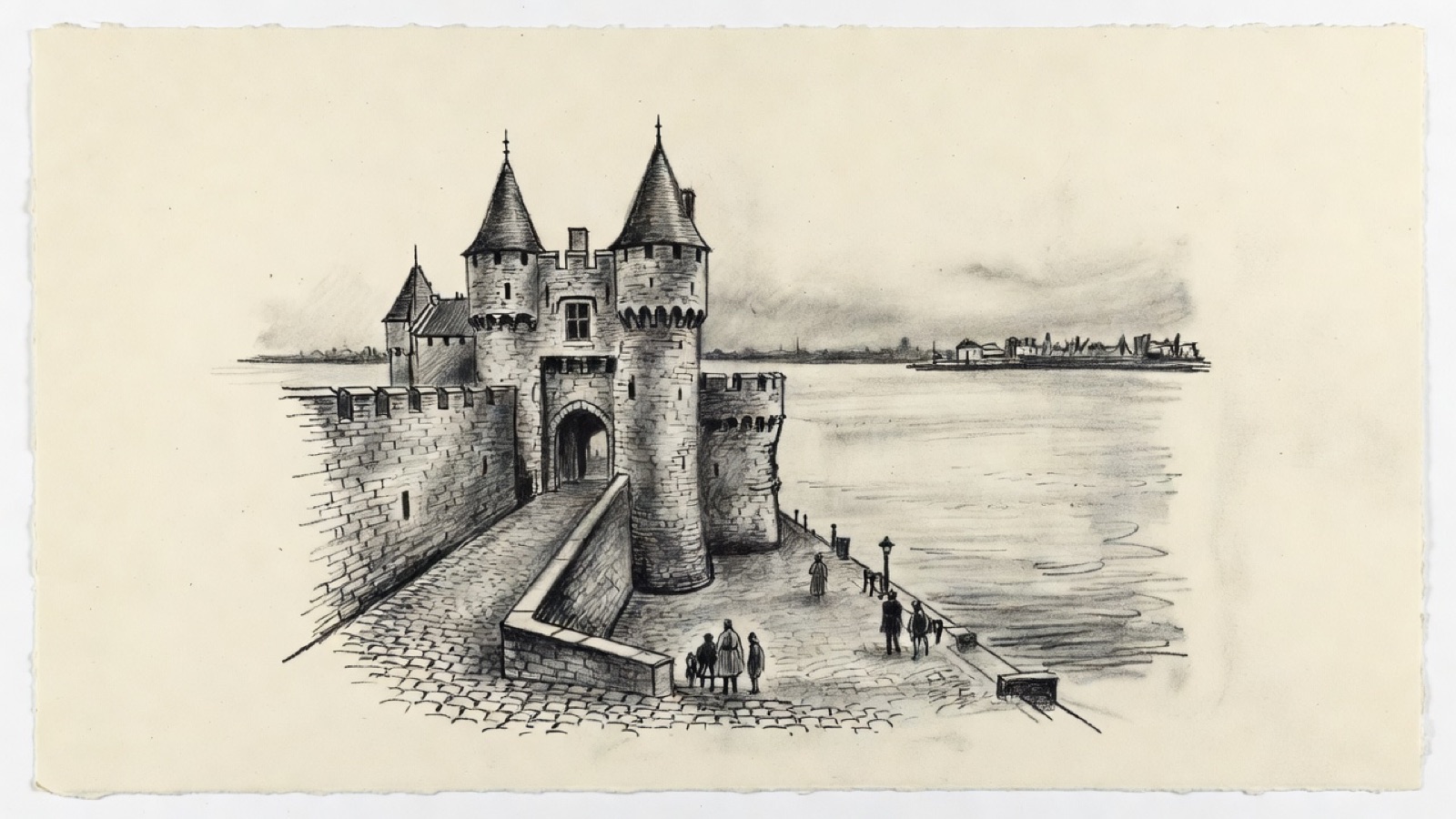
Het Steen · The castle on the Scheldt quay. Charcoal illustration, not a survey drawing.
Antwerp's old town is read here through its churches and the trades that paid for them. St. James' grew from a pilgrims' hostel, the Jesuits built St. Charles Borromeo in six years, and the cathedral, begun in 1352, was never quite finished. The same few painters and sculptors supplied all of them, which is why the names of Rubens, Jordaens and the Quellinus and Verbrugghen workshops return from one stop to the next.
The second thread is commerce. The exchange of 1531, the butchers' hall, the Plantin press, the diamond and silver collections of DIVA and the Boerentoren each mark a different century of the city's business, and Het Steen and the Brabo Fountain tie that business to the Scheldt. The walk ends in the south, at a church whose parish was once known for its poverty and at the site of an abbey founded in 1124, of which nothing stands.
Before you set off
This route was drawn on the map and has not been walked by us yet. It has not been assessed for step-free access.
Your pace, your stops
We don’t give walking times: everyone moves through a city at a different pace. A route is a suggestion that links places worth seeing. You decide where to stop and what you can take on today.
01A convent church that passed to the city's Protestants.51.2233° N · 4.4117° E
Brabantsche Olijfberg
Brabantsche Olijfberg is the name of Antwerp's Protestant community, and it goes back to the years of the Austrian Netherlands, when that community had to meet in secret. The church on the Lange Winkelstraat carries the same name. Its first stone was laid in 1615, it is late Gothic and a listed monument, and it is the only part left of the convent of the Annunciate sisters, a Roman Catholic house. Since 1821 it has served the Antwerpen-Noord congregation of the United Protestant Church in Belgium.
Next to it is the Louis Meeus building.
Next on footSt. James' Church lies to the south.
02A pilgrims' church, and the place where Rubens is buried.51.2205° N · 4.4107° E
St. James' Church
Before there was a church here there was a hostel with a chapel for pilgrims on their way to Santiago de Compostela, and St. James' still serves travellers on that road. The building is Brabantine Gothic, the work of the Waghemakere family and Rombout Keldermans. It was once a collegiate church.
Inside, the Gothic shell holds a mostly Baroque interior with 24 altars. Maerten de Vos, Rubens and Jacob Jordaens painted for it. The marble sculpture and the furniture are by Antwerp carvers: Michiel van der Voort the Elder and Jan Claudius de Cock worked here, and so did Artus Quellinus the Younger and Pieter Verbrugghen the Elder. Many well-known citizens lie here, including Rubens and his wife, Helena Fourment.
Next on footThe Bourgondische kapel lies to the west.
03A chapel on the Markgravestraat, beside the old exchange.51.2203° N · 4.4076° E
Bourgondische kapel
The Bourgondische kapel is a chapel at Markgravestraat 17. Beside it is the Handelsbeurs, the Stock Exchange, which dates from 1531 and was the first building anywhere put up for a commodity exchange. It was rebuilt after a fire in 1858.
Next on footHendrik Conscienceplein lies to the west.
04The Jesuits' square, and the city's first without cars.51.2210° N · 4.4042° E
Hendrik Conscienceplein
Until 1883 this was the Jezuïetenplein. That year it took the name of Hendrik Conscience, the Flemish writer of the nineteenth century, whose statue by Frans Joris stands on it, and the Erfgoedbibliotheek Hendrik Conscience moved into the former Sodality on the square. Part of the building around it dates from the seventeenth century and is Baroque. The Jesuits wanted that display: it belonged to the Counter-Reformation, and the order used it to draw people to church.
The paving is from 1972. Four years earlier the action group VAGA, which counted the artists Hugo Heyrman and Panamarenko among its members, had staged a protest here with blocks of ice, and the city decided to lay the square out again without cars, the first in Antwerp. Dries Jageneau, a young architect in the city's service and a VAGA member himself, drew a draughtboard of white squares and let the paviours fill each one with a pattern of their own. He kept the middle for himself. A keen card player, he had the four aces set there.
Next on footThe Carolus Borromeuskerk is on the square, to the east.
05The Jesuits' church, and the Rubens ceiling that burned.51.2210° N · 4.4052° E
St. Charles Borromeo Church
The Jesuits built this church between 1615 and 1621. Their church was closed in 1773, and six years later the building was dedicated again, this time to Saint Charles Borromeo.
Its fame used to rest on 39 ceiling paintings by Rubens. Lightning hit the church on 18 July 1718 and the fire that followed destroyed all of them. After the tomb at St. James', this is the second place on the walk where Rubens is present mainly as something missing.
Next on footThe Snijders&Rockox House lies to the north-east.
06The homes of a painter and a mayor, side by side.51.2218° N · 4.4061° E
Snijders&Rockox House
Two adjoining townhouses make up this museum. One belonged to the artist Frans Snyders (1579–1657), the other to the mayor Nicolaas Rockox (1560–1640), so the people who made the pictures and the people who governed the city were literally neighbours. The houses now belong to KBC Bank and show Flemish art of the sixteenth and seventeenth centuries. The bank's name comes back later, on a tower.
Next on footThe Letterenhuis lies to the north-west.
07Where Flemish writing is archived.51.2228° N · 4.4048° E
Letterenhuis
The Letterenhuis, the House of Literature, is a non-profit body with two jobs: it is an archive and documentation centre, and it is a museum. It gathers material on Flemish writers, artists and musicians, along with portraits relating to Flemish culture from 1750 onwards.
The manuscripts are the heart of the collection. Hendrik Conscience, whose square you have just left, is here, as are Willem Elsschot and Tom Lanoye. In 2012 an exhibition marked a hundred years since the birth of Louis Paul Boon.
Next on footSt. Paul's Church lies to the north-west.
08A Gothic body, a Baroque tower and a Calvary in the open air.51.2238° N · 4.4012° E
St. Paul's Church
St. Paul's stands at the Veemarkt. The outside is largely Gothic, topped by a Baroque tower, and the inside is thoroughly Baroque. Rubens, Anthony van Dyck and Jacob Jordaens all have paintings here, and several sculptors already met at St. James' worked here too, alongside Artus Quellinus the Elder and Andries Colyns de Nole.
The part that needs no door is the Calvary outside the church: 63 statues at life size and nine reliefs, carved in a popular, theatrical manner.
Next on footThe Vleeshuis lies to the south-west.
09The butchers' guildhall.51.2226° N · 4.3991° E
Vleeshuis
The Vleeshuis, the Meat House or Butcher's Hall, was a guildhall and is now a museum. Three streets hem it in: the Vleeshouwersstraat, the Repenstraat and the Drie Hespenstraat. The last of these climbs to the Burchtgracht, and that rise used to be called the Bloedberg, the Blood Mountain.
Next on footHet Steen lies to the west.
10The oldest building in the city.51.2228° N · 4.3975° E
Het Steen
Het Steen is what remains of a castle of the Dukes of Brabant. It went up between 1200 and 1225 to serve as the gateway to a much larger stronghold, and the rest was pulled down in the nineteenth century. As the city's first fortification in stone it is the oldest building in Antwerp, and it belonged to the earliest core of the town.
The name is usually put into English as the rock, though that is not quite where the word comes from.
Next on footThe Eugeen Van Mieghem Museum lies to the south.
11The shipowners' house on the Scheldt quay.51.2215° N · 4.3973° E
Eugeen Van Mieghem Museum
Since 2010 the museum has occupied the former Redershuis, the shipowners' house, at Ernest van Dijckkaai 9 on the Scheldt quay. The building is in a neo-Italian Renaissance style and stands beside the Museum De Reede, facing Het Steen. The Royal Belgian Shipowners' Association bought and restored it, then lent two of its floors to the Eugeen Van Mieghem Foundation as an act of patronage.
The collection is graphic art. About 200 works by Eugeen Van Mieghem hang in order of date, and they dwell on cultural life in Antwerp and Flanders around 1900. They are on the ground floor and the second floor, which also has the Red Star Line treasure room.
Next on footThe Brabo Fountain lies to the east.
12The city's founding legend, in bronze.51.2214° N · 4.3990° E
Brabo Fountain
On the Grote Markt, before the City Hall, a bronze figure is caught in the act of throwing a hand. The figure is Silvius Brabo, the legendary founder of Antwerp, and the hand has been cut from the giant Druon Antigoon; it is on its way into the Scheldt. Jef Lambeaux made the statue, and the fountain, eclectic in style, dates from 1887. It has been a protected monument since 1982.
Next on footThe DIVA museum lies to the south.
13Diamonds, jewellery and silver under one roof.51.2211° N · 4.3987° E
DIVA
DIVA opened in 2018 and brought two older collections together: that of the Antwerp Diamond Museum, which ran from 1972 to 2012, and that of the Sterckshof silver museum, open from 1992 to 2014. More than 500 objects tell how Antwerp came to be bound up with diamonds and gemstones. After butchers and merchants, this is the luxury end of the city's trade.
Next on footThe Cathedral of Our Lady lies to the south-east.
14The largest Gothic church in Belgium, still unfinished.51.2203° N · 4.4002° E
Cathedral of Our Lady
Work on the cathedral began in 1352. A first phase of building closed in 1521, and the church has never been completed in full. Jan and Pieter Appelmans were its architects, and it is the seat of the Diocese of Antwerp. No Gothic church in Belgium is larger, and the tower reaches 123 metres. Its belfry is part of the UNESCO World Heritage listing for the belfries of Belgium and France.
Rubens is here again, this time with major works that survive, in the company of paintings by Otto van Veen, Jacob de Backer and Marten de Vos.
Next on footThe Boerentoren lies to the south-east.
15The twentieth century's answer to the cathedral tower.51.2185° N · 4.4042° E
Boerentoren
The Boerentoren, the Farmers' Tower, went up between 1929 and 1932 as the Torengebouw van Antwerpen; officially it is the KBC Tower, the same bank that owns the Snijders&Rockox House. Jan Vanhoenacker, Émile Van Averbeke and Jos Smolderen designed it in Art Deco, and it was among the very first tall buildings in Europe. Only the Telefónica Building in Madrid had a higher roof at the time.
It began at 87.5 metres. In 1976 a further 8.3 metres raised the roof to 95.8, and the antenna added in 1954 takes the full height to 112.5 metres. Belgium had nothing taller until 1960. In Antwerp it stayed the tallest building, second only to the cathedral among all structures, until the Antwerp Tower passed it in 2019 at 100.7 metres.
Next on footThe Statue of Peter Paul Rubens lies to the west.
16Rubens in bronze, in front of the cathedral.51.2190° N · 4.4018° E
Statue of Peter Paul Rubens
After a tomb, a lost ceiling and paintings in St. Paul's and the cathedral, this is the painter himself. Peter Paul Rubens (1577–1640), the Flemish Baroque master, is shown in bronze and larger than life. Willem Geefs designed the figure in 1840 and it was put up three years later, in front of the cathedral.
Next on footThe next stop is the Groenplaats, the square the statue stands on.
17The square around the statue, south of the cathedral.51.2190° N · 4.4018° E
Groenplaats
The Groenplaats, the Green Square, is the large square that lies south of the cathedral, and the statue marks its centre. Trees and benches make it a place to rest. Cafés stand along its sides and a Hilton hotel occupies the former Grand Bazar building. Under the paving are a car park and the Groenplaats metro station.
Next on footThe Museum Plantin-Moretus lies to the west.
18A printing house that worked for four centuries.51.2183° N · 4.3983° E
Museum Plantin-Moretus
On the Vrijdagmarkt stands the building where the Plantin-Moretus family both lived and ran their press, the Officina Plantina, for four hundred years. The line of printers goes back to Christophe Plantin and Jan Moretus, who started it in the later sixteenth century. The museum tells how printing developed in the city and the leading part this one family played in it. UNESCO made it a World Heritage Site in 2005.
Next on footMoMu, the Fashion Museum, lies to the south-east.
19Antwerp's newest craft, fashion.51.2170° N · 4.3997° E
MoMu
MoMu, short for Mode Museum, is the city's fashion museum and has been in the ModeNatie building on Nationalestraat since 2002. No collection of Belgian fashion anywhere is larger. The Royal Academy's Fashion Department is in the same building, and the museum concentrates on Belgian designers and on that school's graduates, many of whom made their names after studying there in the 1980s and 1990s, Martin Margiela and the Antwerp Six among them.
The link between school and museum is personal. Linda Loppa, MoMu's first director, also founded and led the Fashion Department.
Next on footSt. Andrew's Church lies to the south-west.
20The church of a poor parish.51.2162° N · 4.3979° E
St. Andrew's Church
St. Andrew's was built in the sixteenth century and follows the pattern seen all along this walk: late Gothic outside, mostly Baroque within. It is still the parish church of St. Andrew's. In the nineteenth century most of the people living around it were poor, and it was called the parish of misery.
Next on footThe site of St. Michael's Abbey lies to the south-west.
21The site of an abbey founded in 1124, of which nothing stands.51.2148° N · 4.3931° E
St. Michael's Abbey
Nothing of St. Michael's Abbey stands. Norbert of Xanten founded it in 1124 as a Premonstratensian house. The French Revolutionary Wars left it in ruins, a semaphore station was fitted into the church tower in 1807, and in 1831 the buildings were pulled down.
The walk ends at its site because of what the abbey was. From the twelfth century until that demolition it ranked among the most important churches and monuments in Antwerp, and it is the one church on this route that the city no longer has.
Facts taken from the Wikipedia articles below (Wikipedia contributors, CC BY-SA 4.0) and rewritten for this route; this is not a copy of their text. Generated with editorial rules and checked 10 October 2026. Transport lines come from OpenStreetMap: confirm with the operator before travelling.