Skip to content
← Antwerp

Antwerp / Rail & arrival

Station quarter: the opera, Centraal and the Zoo

A short walk through the streets around Antwerp's main station. It starts at the opera house, passes the square where the city's buses gather and ends at two neighbours: a station building finished in 1905 and, next to it, a zoo founded in 1843.

1.2 km on foot · 5 stops

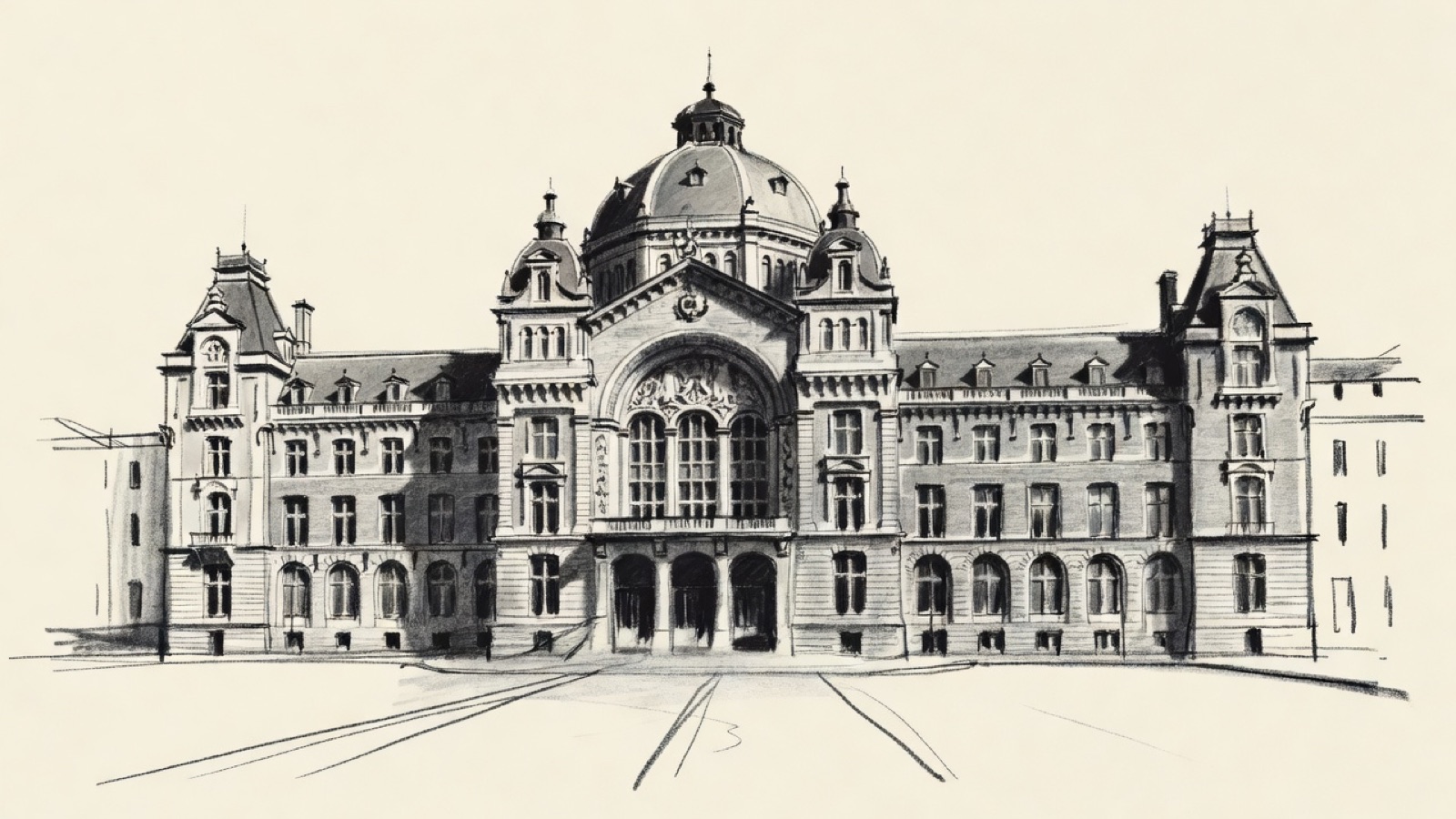
Charcoal illustration of the front of Antwerpen-Centraal station: a stone building with a central dome above a large arched window.
Antwerpen-Centraal · The station building of 1895–1905. Charcoal illustration, not a survey drawing.

Antwerp's zoo was founded on 21 July 1843; Belgium has no older animal park, and the world has few. Antwerpen-Centraal, next to it, was a terminus from 1873. The station building that stands today was designed by Louis Delacenserie and went up between 1895 and 1905.

For close to a century Antwerp had its own city opera, the Koninklijke Vlaamse Opera, until the merger with the opera of Ghent in 1981. Franklin Rooseveltplaats, where the Leien meet the Turnhoutsebaan, is the main bus station. Since 23 March 2007 trains also pass under Antwerpen-Centraal, through a tunnel with two tracks that continues beneath part of the city.

Before you set off

This route was drawn on the map and has not been walked by us yet. It has not been assessed for step-free access.

Your pace, your stops

We don’t give walking times: everyone moves through a city at a different pace. A route is a suggestion that links places worth seeing. You decide where to stop and what you can take on today.

12345N ↑
Royal Flemish Opera0.0 / 1.2 km

Track sketch · north up · not a street map · Route data © OpenStreetMap contributors

01The city opera, independent until 1981.51.2185° N · 4.4160° E

Royal Flemish Opera

The Koninklijke Vlaamse Opera, the Royal Flemish Opera, was Antwerp's city opera, and it stayed independent for almost a hundred years. That ended in 1981 with a merger: the company joined the Koninklijke Opera of Ghent in a single organisation, Opera voor Vlaanderen.

In 2014 that organisation was renamed Opera Ballet Vlaanderen.

Next on footFranklin Rooseveltplaats lies to the north-east.

02A large square given over to buses and trams.51.2196° N · 4.4173° E

Franklin Rooseveltplaats

The Leien and the Turnhoutsebaan meet at this square. Most of what happens on it is transport. It is Antwerp's main bus station, with 28 platforms that carry a large share of the city's bus traffic, and several tram routes use it too.

Two buildings stand beside it. The Antwerp Tower dates from 1974, when it rose 87 m and ranked third in the city after the cathedral and the Boerentoren. A renovation between 2019 and 2021 gave it two extra floors of double height; at 100.70 m it now comes second, and no residential building in Antwerp is taller. The Koninklijk Atheneum Antwerpen, a secondary school that belongs to the GO! school group, also faces the square.

Next on footKoningin Astridplein lies to the south-east.

03A square in the centre, the last stop before the station.51.2184° N · 4.4211° E

Koningin Astridplein

Koningin Astridplein is a square in the centre of Antwerp. De Keyserlei and Carnotstraat are among the streets that open onto it. Franklin Rooseveltplaats and Antwerpen-Centraal are both within walking distance.

Next on footAntwerpen-Centraal lies to the south.

04A terminus from 1873 to 2007, in a building by Delacenserie.51.2169° N · 4.4209° E

Antwerpen-Centraal

This is Antwerp's main station and a major hub of the Belgian network: only four stations in the country are on the high-speed lines, and Antwerpen-Centraal is one of them. Trains are run by the national railway company, NMBS/SNCB.

The station was a terminus from 1873 until early 2007: the tracks ended here. Louis Delacenserie was the architect of the present building, and construction lasted from 1895 to 1905. The change came on 23 March 2007, when a tunnel with two through tracks opened below the station.

Next on footAntwerp Zoo lies to the south-east, next to the station.

05Belgium's oldest animal park, older than the station next door.51.2163° N · 4.4232° E

Antwerp Zoo

ZOO Antwerpen, as it is called in Dutch, sits in the middle of the city, right beside Antwerpen-Centraal. It was founded on 21 July 1843. No animal park in Belgium is older, and few in the world are.

That date puts the zoo here three decades before 1873, the year from which the station was a terminus, and more than half a century before the building that now stands next to it.

End of the routeThe route ends here.

Open in Google Maps Download GPX

This track was calculated on a map and has not yet been checked on foot. Follow public paths and local signs if conditions differ.

Beyond the walk

By public transport from this route

Several places outside this walk are reached by tram from the stop Diamant. The Eisenmann Synagogue and the Machsike Hadass Synagogue are two stops away, at Zurenborg. The Basiliek van het Heilig Hart is four stops away, at Provinciehuis, and the Sint-Laurentiuskerk five stops away, at Markgravelei. The Vlaams Tram- en Autobusmuseum is five stops away, at Keerlus Groenenhoek. The Tank memorial is seven stops away, at Antwerp Expo, and the Kristus-Koningkerk eight stops away, at Volhardingstraat.

Schijnpoort is reached by tram from the stop Astrid: get off at Schijnpoort, three stops on.

These places lie in different directions, so they are not all on the same tram. The network has diversions: check De Lijn before travelling.

Facts taken from the Wikipedia articles below (Wikipedia contributors, CC BY-SA 4.0) and rewritten for this route; this is not a copy of their text. Generated with editorial rules and checked 10 October 2026. Transport lines come from OpenStreetMap: confirm with the operator before travelling.

Another side of Antwerp

More routes in Antwerp

01Faith, trade, craft

Antwerp old town: churches and trades from St. James' to the Scheldt

Rubens is buried at the second stop and stands in bronze near the end, and between the two his paintings hang in three more churches. Around them the walk passes a butchers' guildhall, a fortress gate from the early 1200s, a printing house that ran for four centuries and a tower block from 1932 that was long outdone in height only by the cathedral.

5.2 km on foot · 21 stops

02Care, collecting, stage

Stadspark to the Rubenshuis: care, collections and a city stage

The walk starts in a park laid out on a former fortification and ends at the house a painter redesigned for himself. Between them come the spot where a southern gate once stood, a garden planted for medical students, a home for orphaned girls, and a theatre whose architect also drew the garden's gate.

2.9 km on foot · 9 stops

03Old ground, new uses

The Zuid, where courts and museums took over older ground

The walk starts at a courthouse opened in 2006 where trains used to arrive and ends at a synagogue built in 1893. Between them stand a gate carved in 1624 for a Spanish king and a museum with bronze chariots and seven portrait medallions on its walls.

2.2 km on foot · 7 stops

04Record & trade

Eilandje: a warehouse archive, a war memorial and two museums

A warehouse of 1858 on the Willemdok that now holds the city archive, with the MAS facing it. The route then goes west to the Loodswezen site on the Scheldt quays, where a memorial with about 25,000 names is planned, and north to the Red Star Line Museum. Next to the MAS it passes the site of the Oostershuis, a trading house that burned down in 1893.

1.7 km on foot · 4 stops