01A bridge over two named waters51.2135° N · 3.2259° E
Torenbrug
Torenbrug is a bridge over the Gouden-Handrei and the Augustijnenrei. The same name is used for a street in Bruges.
Next on footWoensdagmarkt lies to the south.
Bruges / Squares and trade
Seven squares lie on this route, from Woensdagmarkt to Oude Beursplein, and Torenbrug at the start spans two named waters. Along the way are a 17th-century Baroque church built by the Jesuits, a palace of 1435 that housed a Medici bank, and a 14th-century building with its date on the façade.
1.6 km on foot · 16 stops
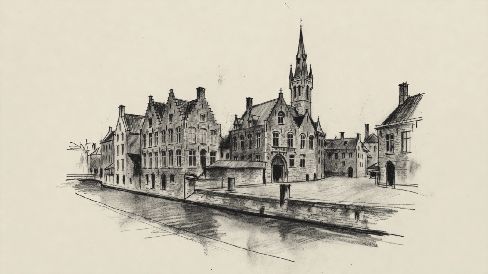
The Poortersloge stands in the part of Bruges that looked to international trade in the late Middle Ages. The bourse at Bruges was established in the 13th century, and the word bourse is commonly traced to an inn and to the Van der Beurze family, whose inn it was. Hof Bladelin was built in 1435 for Pieter Bladelin, and from 1466 it held a branch of the Medici bank of Florence. The Saaihalle, also known as the Natiehuis van de Genovezen, dates from the 14th century. On Jan van Eyckplein, named after the painter, the Old toll house stands diagonally opposite the Poortersloge.
Two churches on the route have a Jesuit history: the Baroque Sint-Walburgakerk of the 17th century and the Heilig Hartkerk, which was deconsecrated in 1990. Museums on the route deal with domestic lighting, chocolate, and potatoes and fries. Seven squares lie along the way, and the route ends at the Stadsschouwburg, built in 1869.
This route was drawn on the map and has not been walked by us yet. It has not been assessed for step-free access.
We don’t give walking times: everyone moves through a city at a different pace. A route is a suggestion that links places worth seeing. You decide where to stop and what you can take on today.
Track sketch · north up · not a street map · Route data © OpenStreetMap contributors
01A bridge over two named waters51.2135° N · 3.2259° E
Torenbrug is a bridge over the Gouden-Handrei and the Augustijnenrei. The same name is used for a street in Bruges.
Next on footWoensdagmarkt lies to the south.
02One of seven squares on the route51.2125° N · 3.2263° E
Woensdagmarkt is a square, south of Torenbrug. It is one of seven squares on this route.
Next on footSint-Maartensplein lies to the south-east.
03The square north of the Jesuits' church51.2113° N · 3.2287° E
Sint-Maartensplein is a square, south-east of Woensdagmarkt. The Sint-Walburgakerk is to the south of it.
Next on footThe Sint-Walburgakerk lies to the south.
04The Jesuits build in Baroque51.2113° N · 3.2287° E
The Sint-Walburgakerk is a Catholic church of the 17th century. The Jesuits were its builders and Baroque is its style, and it serves as a parish church.
Many valuable works of art are kept inside.
Next on footLumina Domestica lies to the west.
05A museum of lighting in the home51.2107° N · 3.2263° E
Lumina Domestica is a lamp museum. It sets out the history of lighting in the home, from the torch and the fat lamp to the incandescent bulb and the LED.
The collection holds about 6,300 objects, antique ones among them, and is said to be the largest collection of lamps in the world. Its showpiece is a lamp made from drawings by Leonardo da Vinci.
Next on footChoco-Story Bruges lies to the south-west.
06A chocolate museum in a 16th-century house51.2106° N · 3.2262° E
Choco-Story Bruges is a chocolate museum housed in Huis de Crone, a 16th-century building on Sint-Jansplein. The house stands where Wijnzakstraat and Sint-Jansstraat meet.
Huis de Crone began as the home of a wine tavern. A bakery occupied it later, and after that a furniture maker's workshop.
Next on footSint-Jansplein lies to the west.
07The square of Huis de Crone51.2105° N · 3.2260° E
Sint-Jansplein is a square in the centre of Bruges. Huis de Crone, the house of Choco-Story Bruges, stands on this square.
Next on footKraanplein lies to the west.
08A square west of Sint-Jansplein51.2105° N · 3.2251° E
Kraanplein is a square in Bruges, west of Sint-Jansplein. Biskajersplein lies to the north of it.
Next on footBiskajersplein lies to the north.
09A small square in the centre51.2113° N · 3.2256° E
Biskajersplein is a small square in the centre of Bruges, north of Kraanplein. Jan van Eyckplein is to the north-east.
Next on footJan van Eyckplein lies to the north-east.
10A square named after a painter51.2115° N · 3.2259° E
Jan van Eyckplein takes its name from Jan van Eyck, the painter of the Northern Renaissance. Three streets meet at the square: Academiestraat, Spiegelrei and Spanjaardstraat.
The Poortersloge and the Old toll house both stand on it.
Next on footThe Poortersloge lies to the west.
11The quarter of international trade51.2115° N · 3.2253° E
The Poortersloge stands on Jan van Eyckplein, diagonally opposite the Old toll house. This is the part of Bruges that looked to international trade in the late Middle Ages.
The Old toll house is a group of buildings: the corner house Het Heilig Graf, the Pijndershuisje, the toll house proper and the house Het Wezelkin.
Next on footThe Heilig Hartkerk lies to the north-west.
12A former Jesuit church51.2119° N · 3.2236° E
The Heilig Hartkerk is a former Jesuit church, the second church on this route with a Jesuit history. It was deconsecrated in 1990 and then used as a hall for celebrations.
A Romanian evangelical community moved into the building in 2022.
Next on footOude Beursplein lies to the south-east.
13The word bourse and a Bruges family51.2111° N · 3.2241° E
Oude Beursplein is a square in Bruges. The bourse at Bruges, bursa Brugensis in Latin and Huis ter Beurze in Dutch, was established in the 13th century. The inn of that Dutch name belonged to the Van der Beurze family, and the word bourse is commonly traced to the family and the inn.
Next on footThe Frietmuseum lies to the west.
14Potatoes, fries and a dated hall51.2111° N · 3.2239° E
The Frietmuseum is a museum about the history of the potato and the making of Belgian fries.
Next to it is the Saaihalle, also called the Natiehuis van de Genovezen. It dates from the 14th century. No other building in Bruges with a date on its façade is older.
Next on footHof Bladelin lies to the west.
15A Florentine bank in a Bruges palace51.2111° N · 3.2224° E
Hof Bladelin is a city palace on Naaldenstraat, built in 1435 on the orders of Pieter Bladelin. From 1466 it housed a bank branch of the De' Medici, the powerful banking family of Florence.
Next on footThe Stadsschouwburg lies to the south-east.
16A city theatre of 186951.2103° N · 3.2236° E
The Stadsschouwburg, in full the Koninklijke Stadsschouwburg, is a theatre and concert hall built in 1869. It is counted among the best preserved city theatres in Europe.
End of the routeThe route ends here.
This track was calculated on a map and has not yet been checked on foot. Follow public paths and local signs if conditions differ.
Facts taken from the Wikipedia articles below (Wikipedia contributors, CC BY-SA 4.0) and rewritten for this route; this is not a copy of their text. Generated with editorial rules and checked 10 October 2026. Transport lines come from OpenStreetMap: confirm with the operator before travelling.
Another side of Bruges
01Guilds, counts & trade
A walk of sixteen stops from a gate on the edge of Bruges to the Markt and the Burg, then on to the trades' squares. Look for two rounded towers on the gate, a belfry leaning to the south-east and slate-spired turrets on the town hall. Further on come a double colonnade round a fish market and a saint clasping a crucifix on a bridge.
02Gates, museums, churches
A bridge in two parts over the Ringvaart opens a route past two city gates and the Poertoren, an 18-metre tower that stored the city's gunpowder from 1477. Further on come BRUSK, the Groeningemuseum, Michelangelo's marble Madonna of Bruges and a church with flying buttresses from the 1270s. The last stop is the statue of Simon Stevin.
03Gate & care
Two round towers painted ochre around the passage of a medieval gate. A uniform row of painted fronts on 't Zand, left over from a bigger plan. Then the béguinage of Bruges, entered by a monumental gate, and a medieval hospital that now holds museums.
04Mills, lace, convents
Two grain mills stand on the Kruisvest, one built in 1770 and one in 1996. Further on come the house where the poet Guido Gezelle was born, the domed church of the Engels Klooster and the lace school of the sisters who began teaching lace in 1717.